Maps
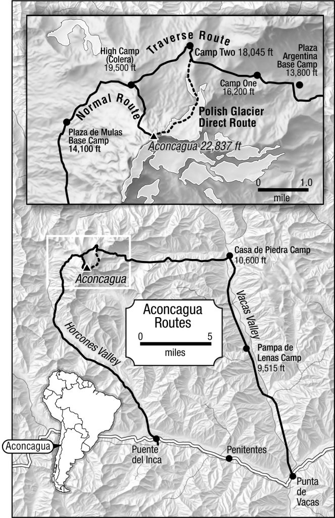
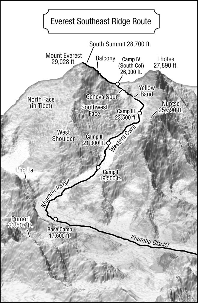
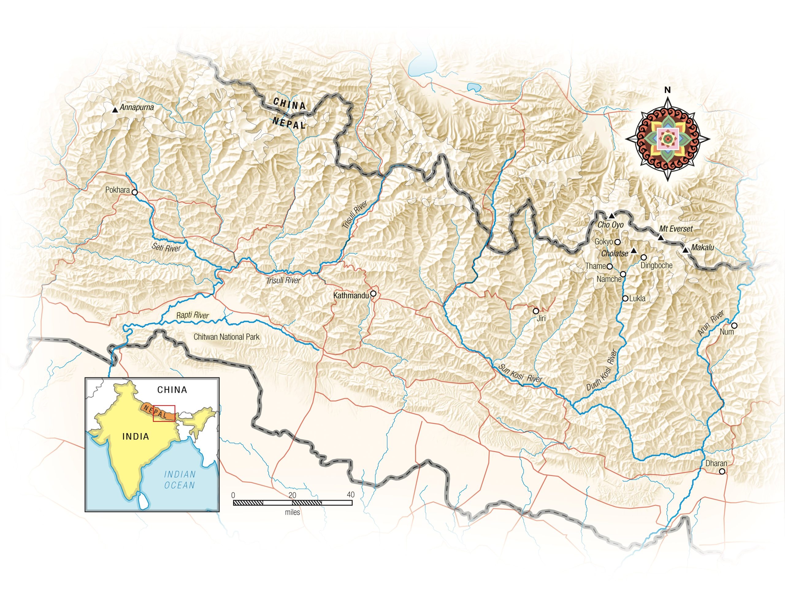
These maps depict some of the trekking and climbing routes described in The Gap Years. The first shows my circumnavigation of Aconcagua, the “Polish Glacier Direct” route I intended to climb, and the “Normal” route I ended up climbing. The second map shows the traditional approach trek to Everest Base Camp that I followed in 1990 and 2021, as well as the extended approach through the Makalu Barun region I chose in 2022. The third depicts the climbing route on Everest followed by the vast majority of expeditions on the Nepal side, including mine in 2021 and 2022. The fourth shows my extended approach trek when climbing Cholatse in 2023.
The color map provides an overview of areas of Nepal referred to in the book, including the four rivers I kayaked in 1982.
All maps by Joe LeMonnier